
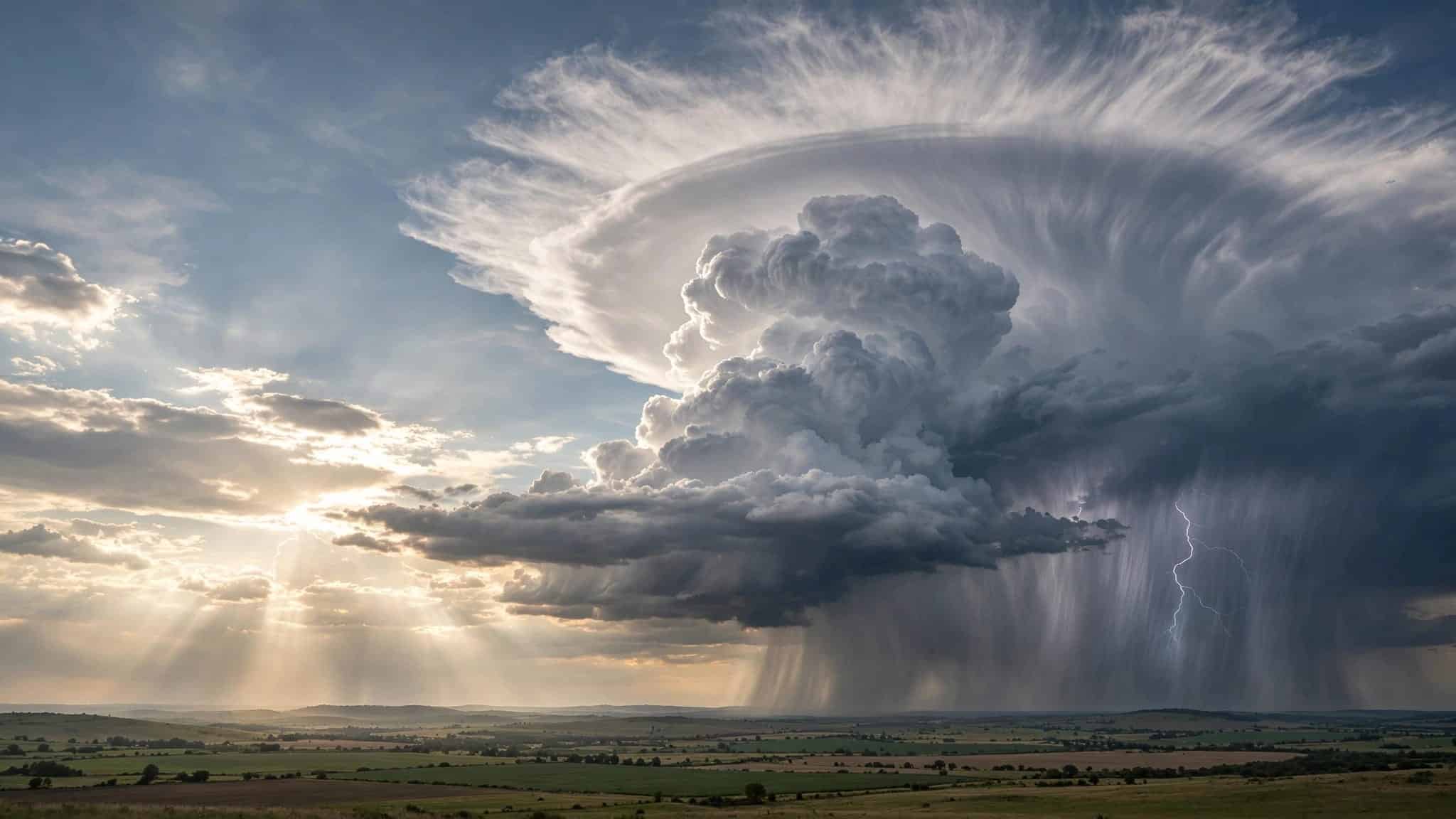
A cloud can look moody without being dangerous. The useful clue is not simply that the sky has turned gray, but whether storm clouds are growing upward, building a dark base, and changing the air around you.
A cumulonimbus cloud is the tall, restless cloud that often marks a thunderstorm, with thunderheads rising above a dark base. It can turn a warm afternoon into rain, hail, lightning, or a sharp gust of wind. Once you know what to look for, the sky starts giving fairly good hints.
This post may contain affiliate links. If you make a purchase through these links, I may earn a small commission at no extra cost to you.
Key Takeaways
- A cloud that grows tall like a cauliflower tower is more concerning than a flat gray layer that simply brings steady rain.
- A broad, flat anvil top often means a thunderstorm has reached its mature stage, but it doesn’t prove severe weather or a tornado.
- Dark bases, rain shafts, sudden wind, lightning, and distant thunder are all reasons to stop treating the sky as scenery.
- A shelf cloud can mean gusty storm outflow is arriving. A wall cloud and funnel cloud need more care, but neither automatically means a tornado is on the ground.
- If you hear thunder, go inside a sturdy building or a fully enclosed vehicle. Watching the clouds can wait.
How to Recognize Storm Clouds Before the Rain Starts
The fastest answer is vertical growth. A fair-weather cumulus cloud looks like a white heap of cotton, wide rather than wildly tall. A developing cumulus congestus cloud grows upward in cauliflower-like towers.
A fully developed cumulonimbus cloud keeps climbing and may spread into a broad, flat top. These towering thunderheads can begin bright and harmless-looking, then develop a darker base as they thicken and gather rain.
Look for a dark base and a rain shaft
A mature storm often has a defined area where rain falls in a curtain or slanted gray shaft. A visible rain shaft is more informative than darkness alone because it shows precipitation is falling.
Cloud color alone is unreliable. Look instead for contrast, vertical structure, rain shafts, and changes in the air. A low, dark base under a tall, boiling cloud deserves more attention than a smooth blanket of gray stratus.

Listen as well as look
Thunder settles one important question: the cloud is a thunderstorm. Lightning can strike well away from the heaviest rain, so a blue patch overhead is not a signed permission slip to stay outside.
A sudden cool gust, leaves turning pale-side up, or a quick shift in wind direction can also mean a storm’s outflow is pushing ahead of the rain. The sky is only part of the scene. The air around you often joins in first.
What Builds a Cumulonimbus Cloud?
A thunderstorm needs three ingredients, and they’re less mysterious than they sound: moisture, unstable air, and a way to lift that air upward. Warm, humid air near the ground is lighter than cooler air above it. If it gets a push, it rises.
That push can come from daytime heating, a cold front forcing warm air upward, air meeting a hill or mountain, or two winds converging near the surface. This organized rising motion is called convection. For a broader look at how fronts and humidity affect everyday conditions, weather basics and forecasting makes a good companion read.
Moisture gives the cloud something to work with
As rising air cools, water vapor condenses into tiny droplets. Condensation releases heat, which helps the rising parcel stay warmer than the surrounding air. It rises farther, gathers more humidity, and the cloud grows upward with alarming enthusiasm.
That is atmospheric instability. It doesn’t mean every humid afternoon will produce a violent storm. It means the atmosphere has enough stored energy for rising air to keep going if conditions line up. As precipitation-cooled air begins descending, a downdraft can develop beside the rising current.
Updrafts make the cloud climb
An updraft is simply a current of air moving upward inside the cloud. A second updraft can carry droplets high into colder air, where ice crystals begin to form.
Wind shear, a change in wind speed or direction with height, can organize that rising air. Some storms stay brief and messy. Others become longer-lived systems with stronger updrafts, more defined rain cores, and possible turbulence or severe weather.
The Three Stages of a Thunderstorm
Thunderstorms do not arrive fully formed. NOAA describes a three-stage thunderstorm life cycle, and convection explains why a cloud’s shape can change so quickly.
The developing stage is all upward motion
Early on, the updraft dominates. The cloud rises into a tall cauliflower shape called cumulus congestus. Precipitation may not be reaching the ground yet, because rising air keeps droplets and ice suspended.
This is the stage that catches people out. A cumulus congestus cloud can build on the horizon while the sky nearby still looks bright.
The mature stage is the rough part
When precipitation becomes heavy enough to fall, a downdraft develops. Air is now moving both up and down inside the same storm. This is the mature stage, when lightning, hail, turbulence, and other severe weather are possible.
Not every short-lived storm produces all these hazards. Still, a fierce cell can do plenty in half an hour, even if it doesn’t last long.
The dissipating stage loses its lift
Eventually, the downdraft spreads out and cuts off the warm rising air that fed the storm. Rain may continue, but the cloud stops building. Its sharp tower softens and breaks apart.
Don’t mistake weakening rain for an instant all-clear. Nearby storms may still be at an earlier stage.
Why a Mature Storm Gets an Anvil Top
The classic anvil cloud looks as if someone flattened the top of a thunderstorm with a very large rolling pin. Rising air reaches the tropopause, where vertical growth becomes limited, then spreads sideways.
High-altitude winds can stretch the upper cloud outward, carrying ice crystals into a broad anvil shape. The anvil cloud may drift far from the precipitation core, which is why lightning risk can extend beyond the heaviest rain.
A crisp anvil is a useful visual clue, but it isn’t a stand-alone forecast. For pilots, it may also signal upper-level turbulence, though an anvil doesn’t automatically mean severe weather. Storm speed, direction, and hazards still require radar, official alerts, and common sense.
A storm can be close enough for lightning even when its rain has not reached you.
Read Shelf Clouds, Wall Clouds, and Scud Carefully
Lower cloud features can look dramatic, and social media has trained many of us to announce a tornado whenever a ragged cloud droops from the sky. It’s better to pause and look at the whole storm.
A shelf cloud often arrives with wind
A shelf cloud is a long, low wedge along a storm’s leading edge. It forms where cool outflow air meets warm air ahead of the storm. Think of it as the gust front made visible.
A shelf cloud can span much of the horizon and look imposing. It often brings a quick burst of wind and a temperature drop, but it isn’t a tornado. Move indoors anyway, because the storm behind it may bring lightning or damaging gusts.

Wall clouds deserve a closer look
A wall cloud is a localized lowering beneath the rain-free base of a thunderstorm. It may appear beneath the rear part of the storm, rather than along the leading edge like a shelf cloud.
A persistent or rotating wall cloud can be associated with tornado development, but it isn’t proof that a tornado is forming. If a lowering appears organized, persistent, or rotating, check official warnings and get to shelter.
Scud and mammatus clouds are not automatic danger signs
Scud is low, ragged cloud material. It can race beneath a storm and look like a funnel cloud, especially when the wind is strong. The National Weather Service notes that these features are often mistaken for more dangerous ones in its storm-spotter guidance. A visual resemblance alone isn’t enough to identify a funnel cloud.
Mammatus clouds are rounded pouches hanging beneath an anvil. They’re striking, sometimes eerie, and often photographed. They can appear near strong storms, but they don’t indicate a tornado by themselves.
Why Storm Clouds Matter So Much to Pilots
For pilots, a cumulonimbus cloud is a major aviation hazard, so they give it a wide berth. A thunderstorm can bring severe weather with several hazards at once. Turbulence, lightning, hail, heavy precipitation, icing, powerful updrafts, downdrafts, and wind shear may occur together.
The FAA’s thunderstorm safety guidance warns that these storms are among aviation’s most serious hazards. Turbulence is particularly dangerous, while supercooled water droplets can freeze onto aircraft surfaces. Near the tropopause, an anvil top can spread well beyond the storm’s core.
The old instinct to fly through a storm’s dark gap isn’t bravery; open areas may still contain turbulence. Aircraft crews use weather radar, forecasts, and air traffic information to give storm cells room.
What to Do When a Storm Is Moving In
Reading storm clouds is useful because it gives you a head start. It should not turn you into the person standing on an exposed hill for a better photograph.
Get indoors when thunder is audible
A sturdy building is best. A fully enclosed vehicle with a metal roof is the next-best option. Open shelters, tents, golf carts, and trees do not protect you from lightning.
If you see a funnel cloud, seek immediate shelter rather than continuing to watch it.
Water makes a bad situation worse. If you are fishing, kayaking, or standing on a beach, leave early rather than waiting for the first drops. These tips on lightning safety while fishing apply well beyond a fishing rod.
Check warnings, not only the view
Clouds show what is happening above you. Weather alerts can tell you what is approaching from beyond the treeline, hill, or skyline.
A severe thunderstorm warning means severe weather is occurring or expected soon in the warned area. A tornado warning requires immediate shelter. If travel plans are involved, it is sensible to know what to do when storms disrupt travel before you are stuck outside with luggage and a stubborn reservation.
Frequently Asked Questions
Can a dark cloud bring rain without becoming a thunderstorm?
Yes. Layered gray clouds can bring long periods of rain without lightning or thunder. A thunderstorm is marked by lightning and thunder, usually with a cumulonimbus cloud that shows strong vertical development.
The difference matters because steady rain can still cause flooding, but it does not carry the same immediate lightning risk.
Does an anvil cloud mean a tornado is coming?
No. An anvil means the thunderstorm has grown high and spread outward near its top. Many thunderstorms make anvils and never produce a tornado.
Tornado risk depends on a more particular set of conditions, including a rotating storm updraft. Treat warnings seriously, but do not diagnose a tornado from an anvil alone.
The Sky Gives Clues, Not Guarantees
The most reliable sign of a storm cloud is a cloud that is building upward, darkening beneath, and producing rain, wind, or thunder. An anvil, shelf cloud, or wall cloud adds useful context, but none should replace an official warning.
Watch the shape, listen for thunder, and notice the changing air. A little weather awareness turns a dramatic sky into a clear decision: go inside before the storm makes it for you.


